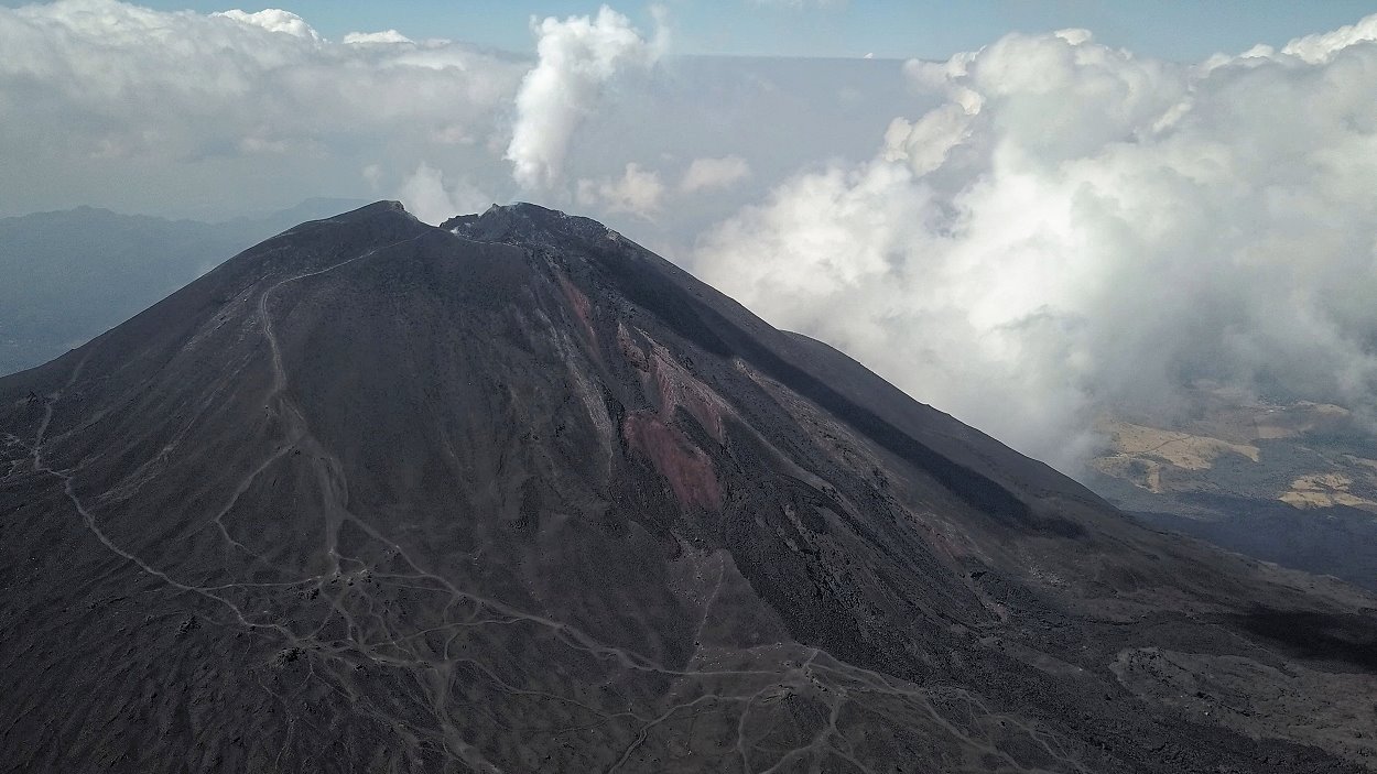
The Pacaya from the air.
The Pacaya rises about 30 kilometers south of the capital of Guatemala and is relatively easily accessible. It is a subduction zone volcano that produces a basaltic to intermediate melt. In addition to basalt, there are dacite (lava domes) and andesitic basalts.
The Pacaya is a young volcano. It was formed about 23,000 years ago on the edge of an older caldera in which Lake Amatitlan also lies.
The complex volcano is composed of several cones and domes and has several peaks. Of these, the Cerro Chino and the Cerro Grande were not active for a long time; the currently active crater cone is the McKenney. It was formed after the flank of an older cone collapsed 1100 years ago. This led to a large landslide, the deposits of which were found 25 kilometers from the Pacaya.
The Pacaya from the air.
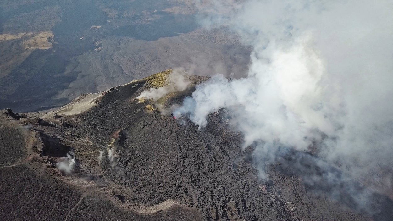
The McKenney crater as seen by the drone.
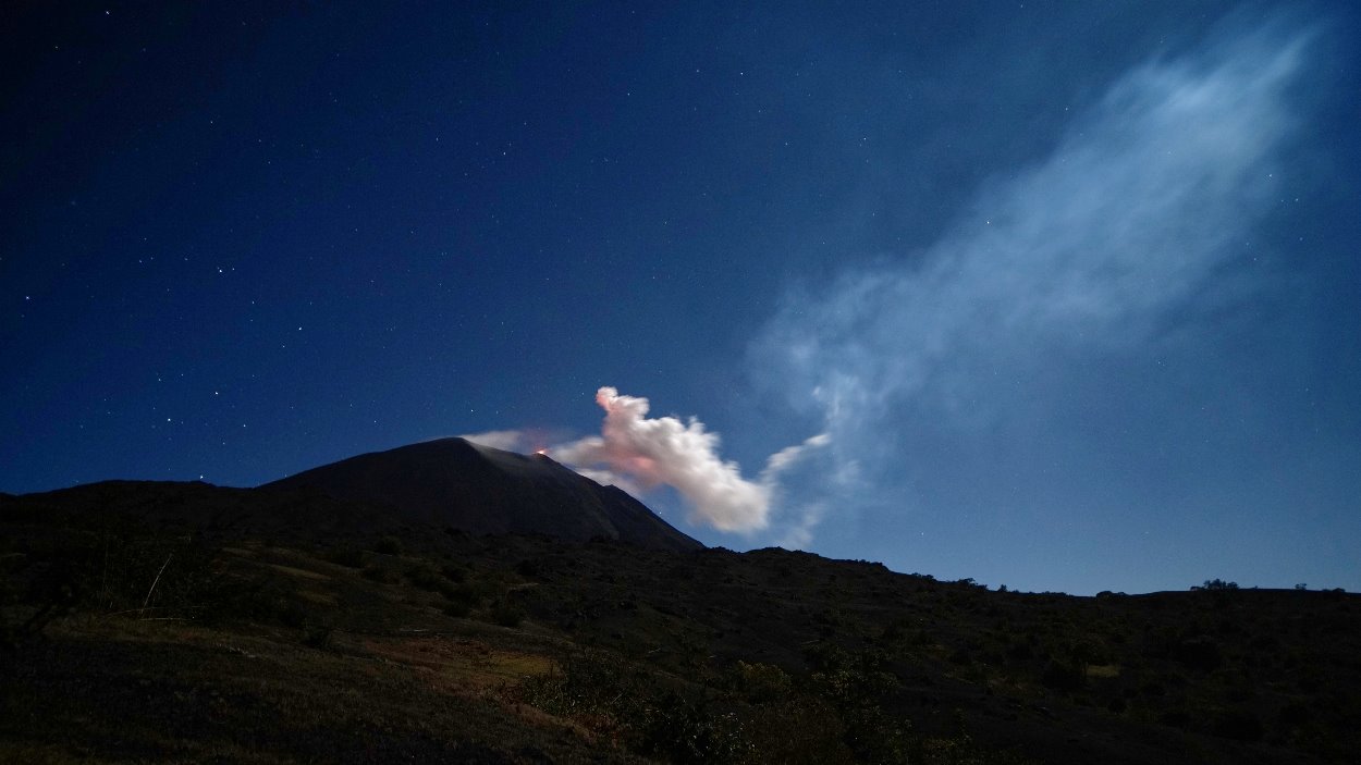
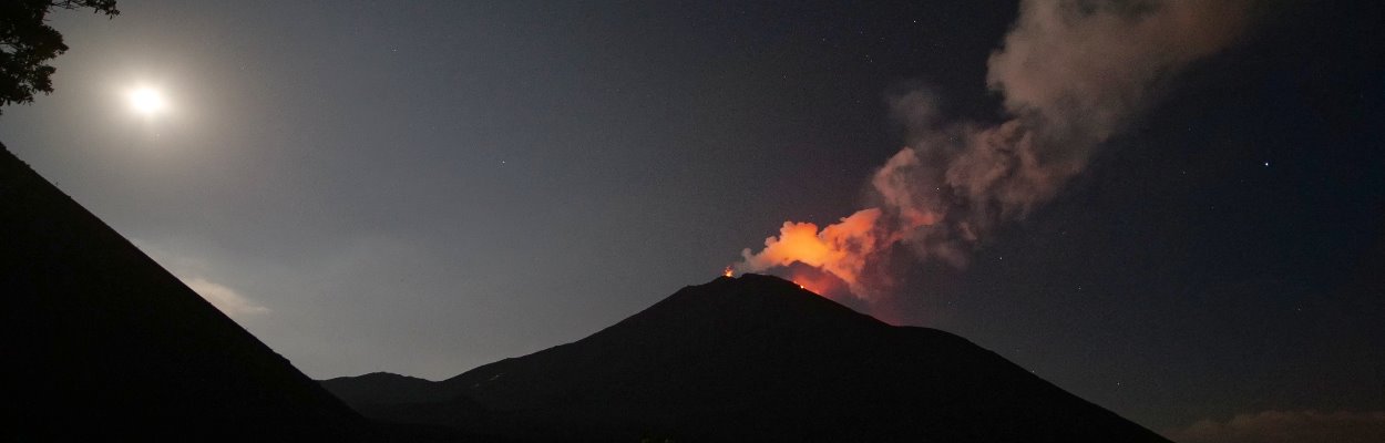
The McKenney crater with a strombolian eruption.
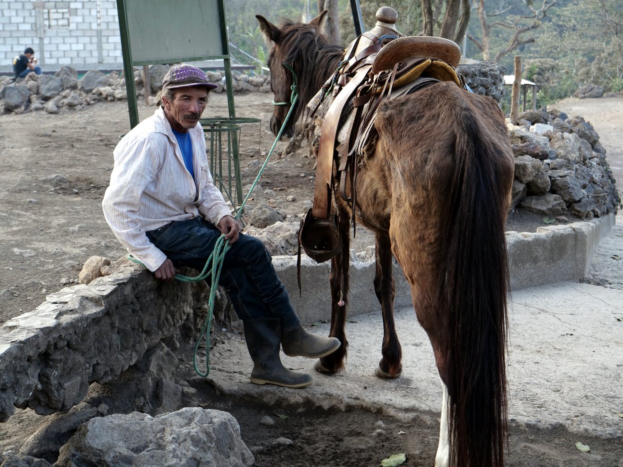 Since the volcano is practically on the doorstep of Guatemala City, it is one of the local recreation areas for the locals: especially on weekends, many visitors are on the move at the volcano. If one arrives without an organized tour, an entrance ticket can be bought at the visitor center in San Francisco de Sales. There are several routes on the Pacaya that can be covered in about 1,5 hours. Thereby, one covers a good 700 height meters. The ascent to the McKenney crater can be exhausting, as the steep path leads over the slope with loose tephra. In active times you should wear a helmet, as you are very close to the conveyor vent. Officially the ascent is then prohibited. A guide is mandatory. If necessary you can ride up the slope on horse/mule. In the vicinity of the park, accommodations are rare. At the park entrance is the spartan Salamandras House, the only accommodation on the site and for people without a car there is no alternative.
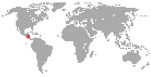
Location: 14.38°N 90.60°W, Guatemala
Altitude: 2.552 m
Form: Complex
Typ: Subduction-Zone-Volcano
Petrography: Andesit - Dacit
Volcanic Activity: vulcanian, strombolian, lava flow, dome